
Town · Lunigiana
Filattiera
The Byzantine Garrison on the Pilgrim Road
Last updated:
- Region
- Lunigiana
- Province
- Province of Massa-Carrara
- GPS
- 44.3294, 9.9322
- Best season
- Spring through autumn (Via Francigena hiking season); October for Profumi d'Autunno
- Time needed
- 1–2 hours (longer if walking a Via Francigena stage)
- Difficulty
- easy
- Known for
- Pieve di Santo Stefano di Sorano, Byzantine origins, Via Francigena stage, Tuscan-Emilian Apennines National Park access
Filattiera is the kind of place that only makes sense if you know what you’re looking at. A small town of roughly 2,200 inhabitants at 320 meters, it sits along the Magra between Pontremoli and Villafranca without any of the dramatic perch or fairy-tale streetscape that draws visitors to other Lunigiana borghi. Its castle is largely ruined. Its center is quiet. But its name — derived from the Greek fulacterion, a fortified garrison — tells a story that reaches back to the 6th century, when this was the front line of an empire.
The Byzantines established their garrison here around 610 AD as part of a defensive line against the Lombards who were pressing south through the Apennine passes. The fortification was documented as Kastron Soreon, and its placement along the Magra Valley was strategic: controlling this stretch of river meant controlling movement between the coast and the Po Valley. When the Lombards eventually took the territory, they inherited the same strategic logic. When the Via Francigena became the great medieval pilgrimage route to Rome, Filattiera was a natural stop. And when the Malaspina divided their inheritance in 1221, Filattiera became the base of the Spino Fiorito (Flowering Thorn) branch — the left-bank dynasty.
What survives from all these layers is concentrated in one building that justifies the visit entirely.
A Place Shaped by Time
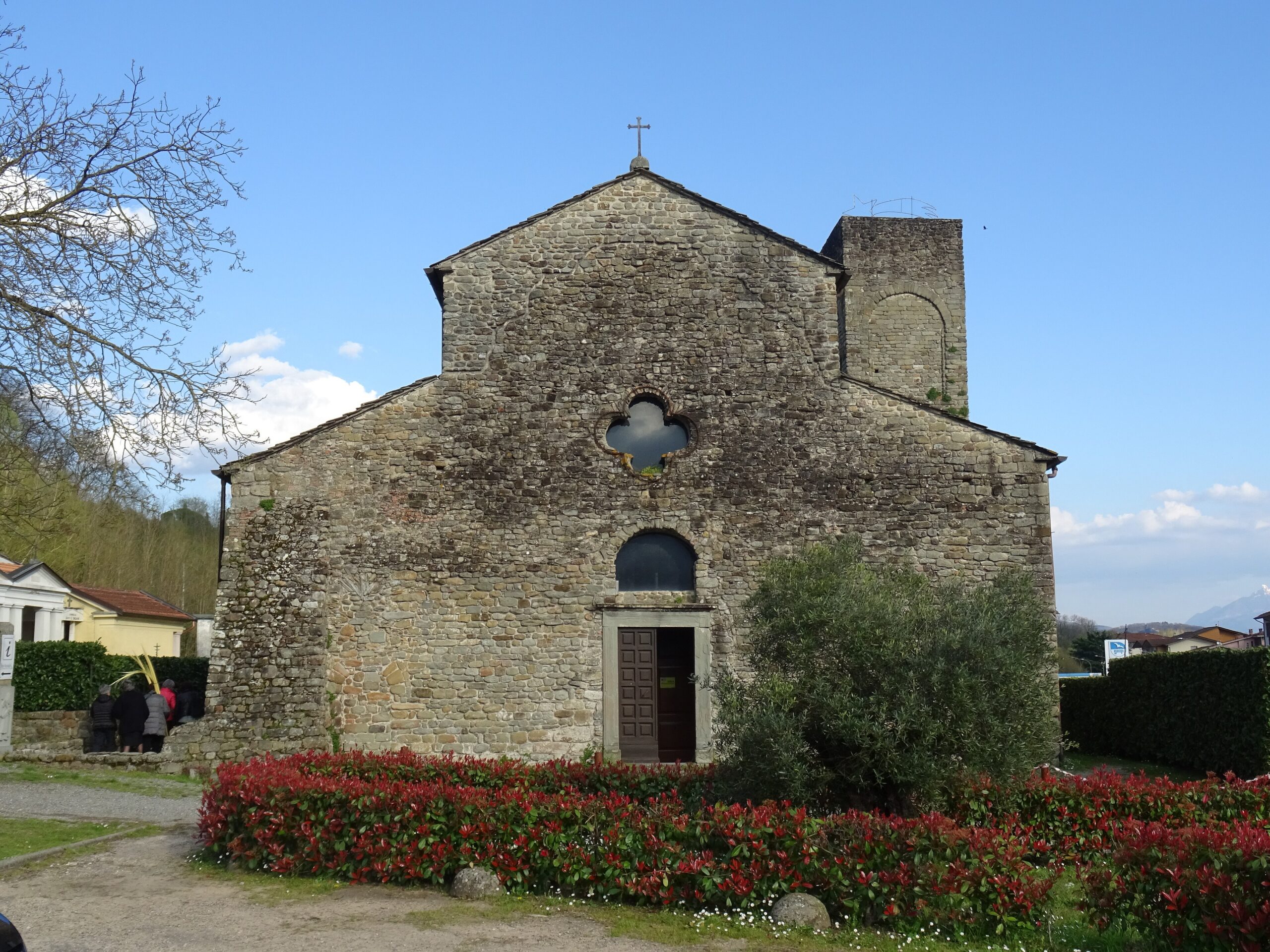
The Pieve di Santo Stefano di Sorano stands just outside Filattiera proper, in the hamlet of Sorano — a Romanesque parish church built, remarkably, from smooth river pebbles gathered from the Magra. This construction technique gives the building a texture unlike any other church in Lunigiana: organic, almost geological, as if the river itself had assembled it. The pebble walls, the apse, the bell tower — all share this distinctive material. Inside, the space is severe and beautiful in the way that only Romanesque churches can be: undecorated stone, proportioned arches, the quiet geometry of 12th-century faith.
The Pieve di Sorano is a highlight of the Via Francigena through Lunigiana. The modern trail passes directly by the church on the stage between Pontremoli and Filetto, making it a natural stopping point for pilgrims walking south toward Rome. The setting — rural, unpopulated, surrounded by fields and low hills with the Apennines behind — reinforces the sense of walking a route that has been in continuous use for over a thousand years.
Filattiera’s Malaspina castle is largely ruined, but its position above the town offers views along the valley. The Spino Fiorito branch that ruled from here controlled the left bank of the Magra — the eastern territories including Aulla and Fivizzano — and their story is one of the threads that runs through every village in southern Lunigiana.
The hamlet of Sorano (not to be confused with the tufa town in Maremma) also serves as a gateway to the Tuscan-Emilian Apennines National Park, with a visitor center providing information on trails, wildlife, and the UNESCO Biosphere Reserve designation (2015). The Lunigiana Bike Area is based here as well, offering guided e-MTB tours including a Castle Cycle Route through the fortified landscape.
What to See and Do
The Pieve di Santo Stefano di Sorano is the essential visit — a 10-minute drive or a pleasant walk from Filattiera center to the hamlet of Sorano. The church is typically open during daylight hours; the exterior alone, with its river-pebble walls, is worth the trip. Allow 30 minutes for the church and its immediate surroundings.
For Via Francigena walkers, Filattiera sits on the stage between Pontremoli and Filetto — a day’s walk that passes the Pieve and continues through forests to the walled village. The trail is well-signposted.
The National Park visitor center in Sorano provides maps, trail guides, and information about the park’s ancient beech forests (UNESCO World Heritage since 2017 for the Casentinesi section), wolf population, and hiking routes. This is the access point for walkers heading into the higher Apennines from the Lunigiana side.
The Lunigiana Bike Area offers guided e-MTB tours for those who prefer wheels — the Castle Cycle Route loops through the valley, connecting Malaspina fortresses via forest roads and quiet lanes.
Profumi d’Autunno — Filattiera’s autumn chestnut festival, typically held on a weekend in mid-to-late October — is one of the many castagnate that fill Lunigiana’s calendar. Roasted chestnuts, chestnut-flour products, local wine, and the particular warmth of a mountain village celebrating its harvest.
Eating Like a Local
Filattiera’s most notable food connection is Trattoria Il Cantinon, mentioned in regional guides for traditional Lunigianese cooking — testaroli, torta d’erbi, seasonal mountain dishes. The hamlet of Sorano is also home to Az. Agr. La Vecchia Cascina di Giulia Lazzerini, one of the named Slow Food producers of Testarolo Artigianale Pontremolese — the version cooked on cast-iron testi over wood fire that holds Presidium status.
The surrounding territory produces DOP chestnut flour from local gradili and contributes to the Miele della Lunigiana DOP honey production.
Getting There and Getting Around
By car: Filattiera is on the main valley road between Pontremoli (15 minutes north) and Villafranca (10 minutes south). No direct motorway exit — use Pontremoli or Aulla on the A15. The Pieve di Sorano is signposted from the main road.
By train: Filattiera station on the Pontremolese line (Parma–La Spezia) provides direct rail access, though services may be infrequent. The station is walkable from the town center.
Timing: The Pieve and Filattiera center can be covered in 1–2 hours. Combine with Villafranca/Filetto (10 minutes south) or Pontremoli (15 minutes north) for a half-day route through the central Magra Valley.
Nearby
Pontremoli — The stele museum, Baroque palaces, and cultural capital. Fifteen minutes north.
Villafranca & Filetto — The Ethnographic Museum and the Byzantine walled village. Ten minutes south.
Mulazzo & Montereggio — Dante’s tower and the booksellers’ hamlet. Fifteen minutes west.
Bagnone — The Bandiera Arancione borgo. Fifteen minutes east.
Tuscan-Emilian Apennines National Park — Accessible via Sorano visitor center, with trails into the UNESCO Biosphere Reserve.
Information is provided in good faith and may change. Always confirm opening hours, prices, and event dates with the official source before you travel.